

Detailed masterplan for Wild Urbanism community with 4800 new homes on River Irk in Manchester City Centre
Red bank is the pivotal phase of the Victoria North project. The sites unique topography is a defining element and its strong connection to the wild and biodiverse fringes of Manchester provides a great opportunity to bring nature into the city. Wild urbanism enhances the urban mix of uses from the city centre into the ecological valley. Wild urbanism reconnects Manchester to its lost rivers and landscape. Public life in Red Bank shall be positive, inclusive, and inviting. A set of agreed baseline rules about the public realm guide all development and can be relied on to create a baseline urban quality provision that will safeguard Manchester’s investments throughout time.
TITLE:
CLIENT:
SITE:
CITY:
PLANNING:
LEARN MORE:
PARTNERS:
Red Bank Manchester Masterplan
Far East Consortium
Red Bank
Manchester, England, UK
Outline and Detail Consent August 2023
Maccreanor Lavington, OPEN, Useful Projects, WSP

Renewable rooftop energy and rainwater harvesting
High quality residential living with green views
Enclosed open residential spaces with play
Commercial offer
Active ground floor use
Verdant sky gardens
Biodiverse aerial corridors of insects and birds connecting the River Irk and beyond
A rich tree canopy
Layered existing and enhanced green infrastructure
An active landscape for all
Strong blue infrastructure
WILD URBANISM
WILD
URBANISM

©Pillar
Nestled in the valley of the River Irk, Red Bank features spectacular topography with levels rising by 15 metres from the bottom of the valley to the links with Cheetham Hills at Creamline Junction. This unique topography provides for spectacular views within and beyond the site. The masterplan creates an accessible set of routes throughout that provide legible and logical ways for disabled or less able-bodied pedestrians and cyclists. Elsewhere, direct routes with stair access are designed to provide intuitive routes along pedestrian desire lines.

©Pillar

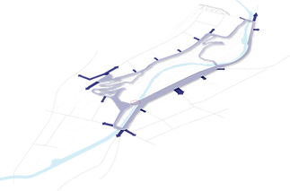
Climate Loop
The Climate Loop is our lead concept for the emergence of a well connected, safe and inviting public realm tissue in Red Bank and Lower New Town. We believe that Manchester’s declared climate emergency must trigger a new way to look at the open spaces of the city and the role that they play in contributing to a more sustainable urban footprint in residential-led urban districts. What started as a simple concept, the Climate Loop has now been refined as a fully fleshed out spatial framework. The Climate Loop puts public life and nature at the heart of all urban life in Red Bank and Lower New Town. In time this framework should also extend into the future development phases, all anchored by the new City River Park.


Strategic Connections
Public Spaces
Active Frontages


Walking & Cycling
Key Public Infrastructure
Promoting Healthy Lifestyles


Experiential Series
Varied Views & Aspects
Biodiversity Corridor